Table of Contents (click to expand)
If the Strait of Gibraltar closed, the Mediterranean Sea would turn into a desert, rather than remaining a body of water.
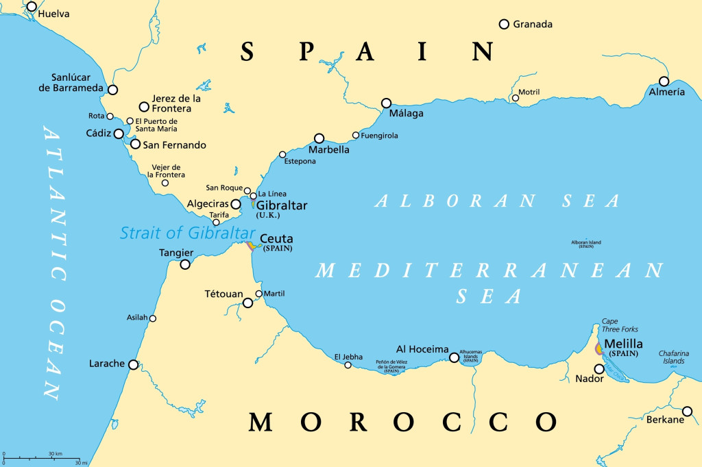
The Strait of Gibraltar is a short waterway that connects the Atlantic Ocean and the Mediterranean Sea. A strait is a narrow stretch of water that connects two seas or other large bodies of water. This 13-kilometer-wide stretch also divides Europe and Africa, with Spain and Gibraltar on one side, and Morocco on the other.
The Mediterranean Sea is almost entirely surrounded by land—the name Mediterranean means “in the heart of the land.” The narrow Strait of Gibraltar is its only connection to the rest of the seafaring globe. The Mediterranean, bordered to the south by hot, arid North African countries and to the north by sunny southern European countries, is recognized for its balmy waters and sunny beaches.

As a result of the region’s warm environment, evaporation is significantly high in the Mediterranean. Evaporation removes considerably more water than all of the largest inflowing rivers combined, including the Nile, Rhone, Po, Arno, and (through discharge from the Black Sea) the Danube. A significant circulation of water from the Atlantic Ocean also pours in via the Strait of Gibraltar, replenishing water that is lost to evaporation. The cool water from the Atlantic warms up and evaporates, which is why the sea becomes saltier as it moves eastward.
Today, the Mediterranean Sea serves as an important engine for worldwide water circulation. Evaporation adds salt to its waters, which pours back into the Atlantic Ocean and aids in driving oceanic conveyor belts that circle the globe, affecting temperature, weather patterns, and more.
What If The Strait Closed?
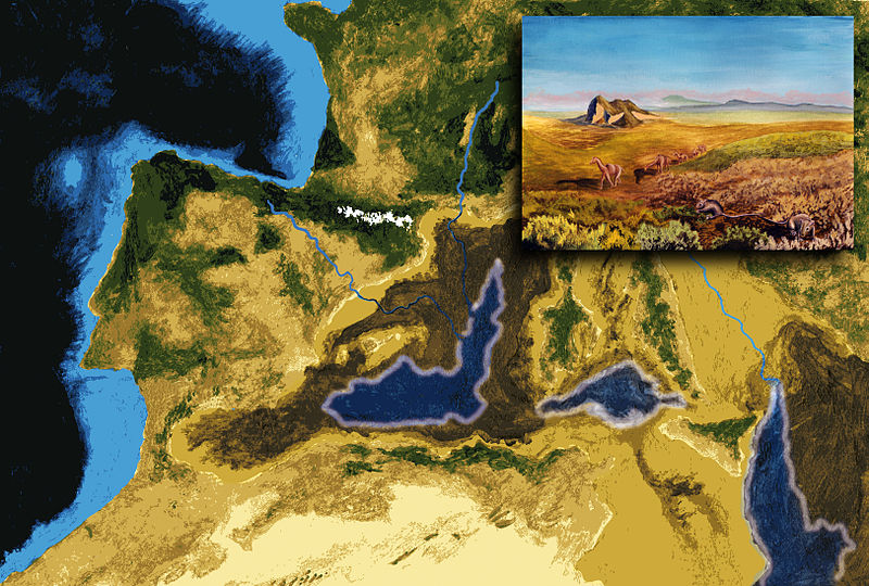
We can predict what might happen if the strait closed, because it happened 5.9 million years ago. It is known as the great Messinian salinity crisis. Profound tectonic movements may have pushed the topography higher, cutting the important link between the Mediterranean and the Atlantic Ocean.
The Strait closed and salt water from the Atlantic Ocean ceased coming in. During such a condition of closure, the sea would transform into a deep, salty lake, then a salt-covered swamp, and eventually a desert.

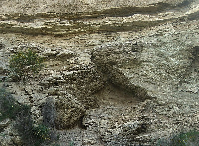
When the strait closed, in just a few thousand years, the water drained into three shallow basins in the sea’s east, west, and center. The evaporite mineral gypsum (CaSO42H2O) was deposited first in each basin, accompanied by halite (NaCl). These compounds are found in places where salty water evaporates.
A scientific research vessel’s drilling found that the ensuing evaporite salt deposits are up to 3 km deep in certain spots. This is way too much for a single evaporation cycle; the drilling data implied that the basins were flooded with saltwater numerous times before drying up and evaporating.
Also Read: What If Our Oceans Became Freshwater?
How Did The Mediterranean Form?
Researchers wondered why the Mediterranean basin was continuously filled with water and then later cut off. As a possibility, low-scale tectonic movements could have generated successive rises and fall in regional land levels, causing a rise and fall in the land barrier in the Strait of Gibraltar.

The most plausible theory is that sea level fluctuated due to fluctuations in the massive Antarctic ice sheet, which started forming around 14 million years ago. The Mediterranean Sea was last refilled 5.33 million years ago, at the border between the Miocene and Pliocene epochs.
A large flood eventually broke the barrier and rejoined the ocean with the sea. The flow of water coming through the narrow strait might have lasted for several centuries and would have been greater than Victoria, Niagara, and Iguazu Falls put together.
Also Read: Would Oceans Become Less Salty If All The Polar Ice Caps Melted?
Is It Possible That The Mediterranean May Dry Up Again?
Africa and Europe are both tectonically active. For millions of years, the African plate, which holds a portion of the Mediterranean seafloor, has been advancing north. It is moving towards the Eurasian Plate Boundary at a rate of roughly one inch every 2.5 years.
According to scientists who have examined the subject, it is quite likely that the Strait of Gibraltar will once again be blocked in the near geologic future.
If the Mediterranean Sea is isolated, evaporation would force it to drop several feet every year. This would eventually reveal over a hundred thousand square kilometers of fresh land. This land would be agriculturally unfit, due to the saline sediments deposited from the salty sea. Blocking off the strait would also result in the rise of global sea levels, as the water evaporated from the Mediterranean would be dispersed throughout the world’s oceans.
How well do you understand the article above!

References (click to expand)
- The Mediterranean nearly dried up. A cataclysmic flood .... National Geographic
- Lelieveld, J., Hadjinicolaou, P., Kostopoulou, E., Chenoweth, J., El Maayar, M., Giannakopoulos, C., … Xoplaki, E. (2012, March 7). Climate change and impacts in the Eastern Mediterranean and the Middle East. Climatic Change. Springer Science and Business Media LLC.
- 15. Strait of Gibraltar, Atlantic Ocean/Mediterranean Sea. Lunar and Planetary Institute
- Skinner B. J.,& Murck B. W. (2010). The Blue Planet: An Introduction to Earth System Science, 3rd Edition: An Introduction to Earth System Science. Wiley Global Education
