
Table of Contents (click to expand)
When water vapor is drawn upwards by strong air currents, it can represent the developmental stage of a cumulonimbus cloud. The weather conditions necessary for such clouds to form include an unstable air mass, sufficient moisture, and an upward force (typically provided by heat).
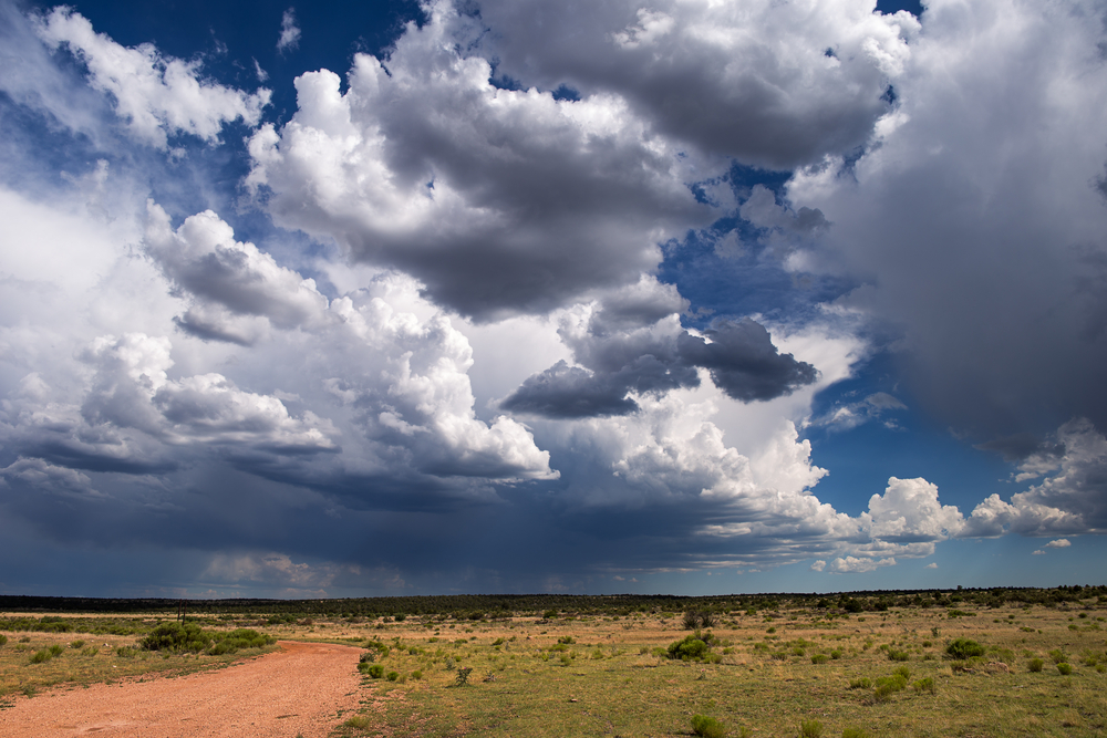
There are few things as pleasurable or nostalgic as a good summer storm. Sitting under a porch, feeling the humidity fluctuate and the air change, watching the thunderheads roll in… there’s no denying that it feels exciting. However, when you’re looking at that storm blowing in, what you’re probably looking at are cumulonimbus clouds, the largest types of clouds we see in the sky! While most people simply think of them as “storm clouds”, there are a number of fascinating facts about this cloud type that make it worthy of our attention.
What Is A Cumulonimbus Cloud?
When water vapor is drawn upwards by strong air currents, it can represent the developmental stage of a cumulonimbus cloud. The weather conditions necessary for such clouds to form include an unstable air mass, sufficient moisture, and an upward force (typically provided by heat).
These types of clouds usually form in tropical areas, where these elements are more commonly found together, but blizzards are another form of precipitation caused by cumulonimbus clouds.
As mentioned, when water vapor (moisture) is drawn upwards through an unstable air mass on a hot day, a cumulonimbus cloud may start to form. The mature stage is evidenced by additional moisture being drawn upwards and condensed once it comes in contact with condensation nuclei high in the atmosphere. These monumental vertical clouds may evolve from other types of cumulus clouds, which hang around 6,000 feet in the air, but the clouds will continue to build and grow, stretching up to 40,000 feet high and beyond!
Once a certain tipping point is reached, these massive clouds will begin outpouring the energy in the form of precipitation, often in brief and violent storms. Most cumulonimbus clouds will dump their contents in around 20 minutes, and then begin to dissipate, but that dramatic downpour can often cause damage and flash-flooding. Furthermore, some cumulonimbus clouds can form a supercell during the mature stage, caused by a consistent and massive rotating updraft. These severe storms can often last for 2-4 hours, but are the least common form of thunderstorms, mostly seen in the Great Plains of the United States.
Cumulonimbus clouds are composed of water vapor near the bottom and ice crystals near the very top, part of the reason why their growth typically has a cap before the storm finally breaks. They are often called thunderheads or storm clouds—even if they don’t produce precipitation, e.g., dry storms—because they are often dark and ominous. The large amount of water and ice crystals in the clouds will absorb and scatter the light, creating their threatening appearance!
Also Read: At What Point Do Clouds Become Heavy Enough To Rain?
Types And Forms Of Cumulonimbus Clouds
To the untrained eye, most storm clouds look the same, but not all cumulonimbus clouds are created equal, and there are some key differences you should understand. The two main species of a cumulonimbus cloud are Cumulonimbus calvus and Cumulonimbus capillatus, which are differentiated by their topmost appearance, the former being puffy but solid, while the latter is more scattered and flurried, like a cirrus cloud.
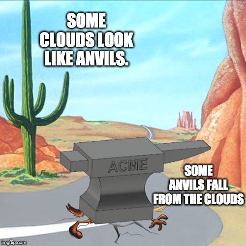
There are also accessory clouds and peripheral features that may be present with cumulonimbus, which can give them a different shape, or perhaps even indicate which direction a storm is moving! For example, when you see a large and imposing cumulonimbus cloud with a top that looks like an anvil, that is an incus, and forms when the cloud reaches its very highest point. The strong winds that high in the atmosphere will shear off the top, creating the appearance of a flat top.
These clouds may line up to form a storm front, in what is called a flanking line, or a small tube/funnel will dangle down from the clouds, with the potential to form a tornado! Some of these massive clouds will also form small bubbles on the underside, called mammatus. The majority of these clouds are associated with precipitation, but as mentioned earlier, some of these clouds will only be known by their thunder and lightning. In some cases, the precipitation will mostly or completely evaporate before reaching the ground. In desert areas, or during a drought, this can lead to forest fires, since the lightning may still be severe, but there won’t be any rain to douse the flames.
Also Read: Why Do Clouds Look Dark?
A Final Word
Cumulonimbus clouds are the most iconic, beloved and feared clouds on our planet. They are certainly the most impressive, rolling out from over the horizon like a vengeful wave of anger and retribution. They can bring life-giving rain, but they can also deliver devastating floods and crushing rain, as well as hail or blizzards, depending on the region and local temperature. While these clouds can form anywhere on the planet, they are primarily found in tropical areas, where violent (and brief) summer storms are the norm.
So, the next time you hear a rumble in the distance, bring your friends outside and give them the lowdown on cumulonimbus clouds… just make sure you get back inside before the bottom falls out and the rain begins to pour!
How well do you understand the article above!

References (click to expand)
- Cloud Classifications and Characteristics. The National Weather Service
- Types of Clouds | NOAA SciJinks – All About Weather. scijinks.gov
- Pruppacher, H. R., & Klett, J. D. (2010). Microstructure of Atmospheric Clouds and Precipitation. Microphysics of Clouds and Precipitation. Springer Netherlands.
- Cloud Cards. The National Park Service
- Hobbs, P. V., & Rangno, A. L. (1985, December). Ice Particle Concentrations in Clouds. Journal of the Atmospheric Sciences. American Meteorological Society.